Mapmaker(s): swagman090
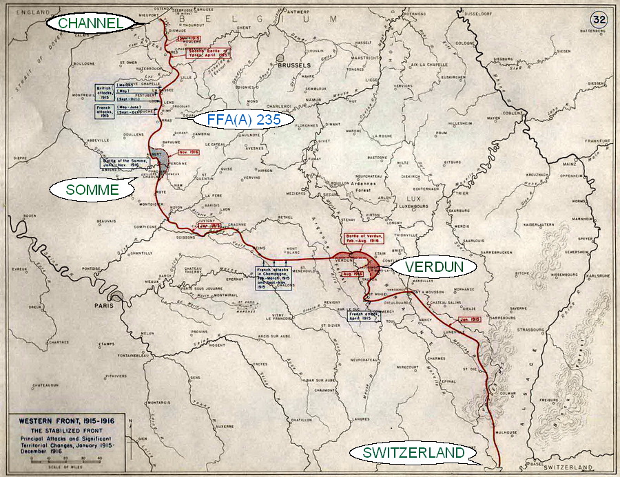
Number of Territories: Territories could be cities or sections of the front lines. For example, Paris could be its own territory and an area that a given division was holding in 1916 could be one as well. Continents could be areas of Armies, for example, all of the territories for the British 4th Army could be a "continent". They could also be countries, or areas where a given country's forces were. For example, you can see Luxembourg in the bottom right corner of my map below. That could be a "continent".
Special Features: One way bombardments from ships that will be put in the Channel; one way attacks across trench line; rivers impassable
What Makes This Map Worthy of Being Made: I'm a big history buff, and I'd like to see more WW1 maps here. 1916 was at the height of the Great War, so why not make a map of it?
Map Image:
- Click image to enlarge.