Page 1 of 1
ITALY MAP HISTORY

Posted:
Fri Sep 15, 2006 12:20 amby matteo11
This thread is a graphical documentation of the drafts for the Conquest Italia map for those who would like to be able to see its historical progression. If you would like to comment on any of these maps or on the general idea please do so in the '[poll]Conquest Italia' thread.
Thank you,
--matteo11
original idea
Posted:
Fri Sep 15, 2006 12:24 amby matteo11
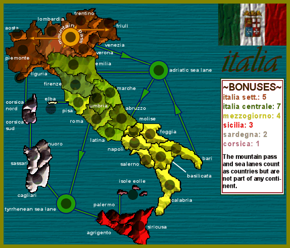
This is a later stage draft of the original idea:
alternate
Posted:
Fri Sep 15, 2006 12:25 amby matteo11
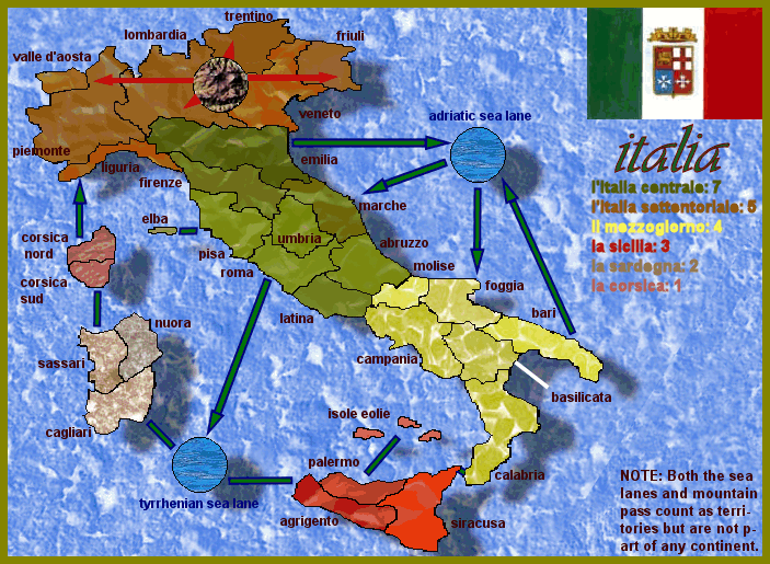
This is the first draft of an alternate idea for the map:

2nd alternate draft
Posted:
Fri Sep 15, 2006 12:32 amby matteo11
This is the second draft for the alternate idea:
above draft + names
Posted:
Fri Sep 15, 2006 2:41 amby matteo11
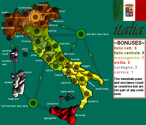
This is the above draft with names added plus a decorative flag and the bonuses legend.

Posted:
Fri Sep 15, 2006 2:44 amby gavin_sidhu
The problem with your alternate one is that you cant tell the difference between the countries, especially for italia sett. I still voted for i though.
Posted:
Fri Sep 15, 2006 3:17 pmby Evil Pope
Maybe you could find a way to make the borders more visible in the alternate version.. You could possibly change their color to something lighter..
Posted:
Fri Sep 15, 2006 3:31 pmby Mr. K
I love the idea, but if I may say, the alternate version, the textures are very....harsh. Almost painful to look at for more than a few moments. Especially the water. I think this map would benifit greatly by toning the textures down a great deal, and softening up the color difference with the water. What I mean by that is, its like every pixel is either bright white or dark blue, if you can kind of blur them together to get a softer picture it would be much easier on the eyes.
Posted:
Fri Sep 15, 2006 3:37 pmby dussle
I dont like them either, but I can decipher them all easily enough with the exception of Italia sett. A few things will help.
1. Once we actually get number in there, that'll make life easier.
2. Bolder lines, or thin lines in a color that stand out, would certainly help.
Posted:
Fri Sep 15, 2006 4:09 pmby onbekende
Didn't anyone moticed Corsica and Sardinia, when you hold both, 1 territorie needs defending for a total of 3 bonus army's
Posted:
Fri Sep 15, 2006 9:54 pmby gavin_sidhu
onbekende wrote:Didn't anyone moticed Corsica and Sardinia, when you hold both, 1 territorie needs defending for a total of 3 bonus army's
Since when was Corsica part of Italy anyway? Its French.
borders
Posted:
Sat Sep 16, 2006 12:14 amby matteo11
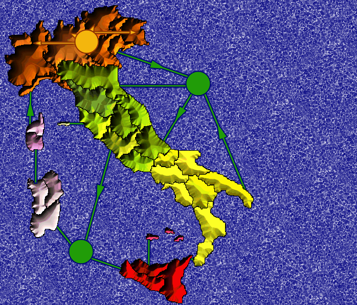
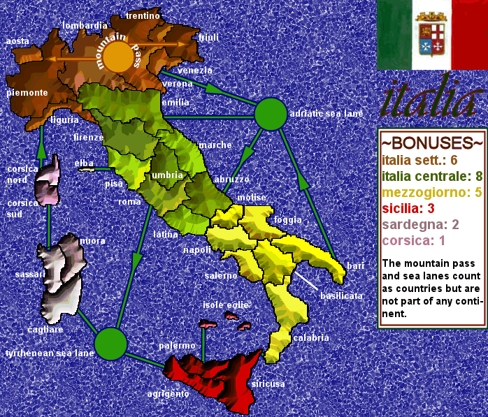
Many issues have been brought up, but this draft version only trys to resolve the 'border' problem of Northern Italy(Italia Settentoriale). The mountains have been toned down, a flat mask layer added, and the borders thickened. I would like to thank everyone for their valuable input.
Posted:
Sat Sep 16, 2006 1:43 amby matteo11
small version of the above map with army circles and without the fancy sea:
Posted:
Sat Sep 16, 2006 1:56 amby reverend_kyle
CAPITALIZE!
but do it properly.. unlike what I did in that part of the post.
Posted:
Sun Sep 17, 2006 5:14 pmby matteo11
Some name corrections (thanks to Lupo) and added graphical effects.