Page 14 of 22
Re: Land And Sea v12p19 S&L
Posted: Sun Feb 01, 2009 2:01 pm
by gimil
ZeakCytho wrote:Sorry Gimil, but I'm gonna hop on the bandwagon and ask that you reduce the opacity in the top right box, at least. It's a bit hard to read the text over it.
Otherwise, this is looking really nice. Good work Ed and Gimil

I am thinking of a way to fix this issue zeak. Unfortuantly opacity isn't the way to go. I gave it a try and it makes the map look lop sided and it appears t be to pale to work which the rest of the maps colour scheme.
Re: Land And Sea v12p19 S&L
Posted: Mon Feb 02, 2009 5:50 pm
by gimil
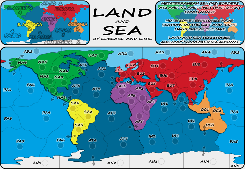
Cairns how is this? I brought the transparency down 10% and increased the stroke opacity from 30% to 60%:
- Click image to enlarge.
Re: Land And Sea v12p19 S&L
Posted: Mon Feb 02, 2009 6:39 pm
by cairnswk
Gimil, can you place a bigimg tag around that for me as your credentials are interfering with the top right corner viewing.
Re: Land And Sea v12p19 S&L
Posted: Mon Feb 02, 2009 6:42 pm
by gimil
cairnswk wrote:Gimil, can you place a bigimg tag around that for me as your credentials are interfering with the top right corner viewing.
whoops

I should practise what I preach


Edit: DONE
Re: Land And Sea v12p19 S&L
Posted: Mon Feb 02, 2009 6:55 pm
by cairnswk
gimil wrote:Cairns how is this? I brought the transparency down 10% and increased the stroke opacity from 30% to 60%:
Gimil, I'm almost happy with it, and i can see you've reduced the opacity, but.
Can you reduce the right map another 10% to bring it to 20% opacity, and then reduce the left map by 10%, please. If i had the file i'd test it myself to see what it looked like, and i'd like to hear from some others of this is a good solution.
Re: Land And Sea v12p19 S&L
Posted: Mon Feb 02, 2009 7:05 pm
by gimil
reducing each map by 10%, I felt, was to much when I looked at it. I went for 5% as a compromise, if this is alright cairns let me know so that I can get the small here for the stamp.
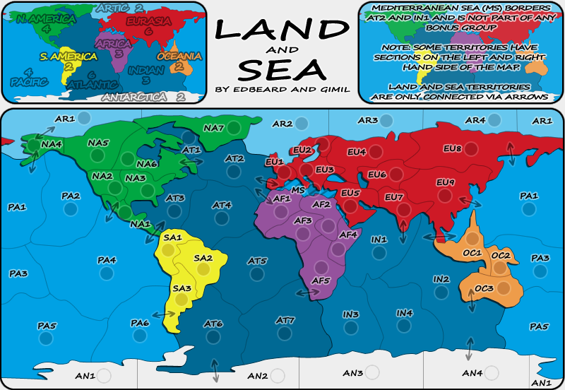
- Click image to enlarge.

Re: Land And Sea v12p19 S&L
Posted: Mon Feb 02, 2009 7:34 pm
by cairnswk
gimil wrote:reducing each map by 10%, I felt, was to much when I looked at it. I went for 5% as a compromise, if this is alright cairns let me know so that I can get the small here for the stamp.
Good for me Gimil,
but i'd still like to hear from others is this is OK.
Re: Land And Sea v12p19 S&L
Posted: Mon Feb 02, 2009 9:03 pm
by Incandenza
I find the legend bits very readable and rather attractive (and the corners on the map border look better too).
Re: Land And Sea v12p19 S&L
Posted: Mon Feb 02, 2009 9:52 pm
by InkL0sed
Looks good to me.
But you're still missing the c in Arctic.
Re: Land And Sea v12p19 S&L
Posted: Tue Feb 03, 2009 6:18 am
by gimil
InkL0sed wrote:But you're still missing the c in Arctic.
Thanks ink I will fix it when I update later on today.
Re: Land And Sea v12p19 S&L
Posted: Tue Feb 03, 2009 6:56 pm
by sailorseal
I like this map. It's a very cool idea. What bonus is MS part of? I also do not understand that arrow on PA4.
Great map!
Re: Land And Sea v12p19 S&L
Posted: Tue Feb 03, 2009 6:57 pm
by the.killing.44
sailorseal wrote:I like this map. It's a very cool idea. What bonus is MS part of?
Read the key … it says none.
sailorseal wrote:I also do not understand that arrow on PA4.
Great map!
The arrow goes across, acting like the Panama Canal so Pacific can attack Atlantic.
.44
Re: Land And Sea v12p19 S&L
Posted: Tue Feb 03, 2009 7:07 pm
by sailorseal
the.killing.44 wrote:sailorseal wrote:I like this map. It's a very cool idea. What bonus is MS part of?
Read the key … it says none.
sailorseal wrote:I also do not understand that arrow on PA4.
Great map!
The arrow goes across, acting like the Panama Canal so Pacific can attack Atlantic.
.44
Sorry kil you are looking at the wrong arrow, you see there are two, I am talking about the top arrow...
Re: Land And Sea v12p19 S&L
Posted: Tue Feb 03, 2009 7:08 pm
by the.killing.44
sailorseal wrote:Sorry kil you are looking at the wrong arrow, you see there are two, I am talking about the top arrow...
Oh, then what's not to get? It's just like any other arrow besides the lower one — it connects to NA1…
.44
Re: Land And Sea v12p19 S&L
Posted: Fri Feb 06, 2009 5:51 am
by yeti_c
the.killing.44 wrote:sailorseal wrote:Sorry kil you are looking at the wrong arrow, you see there are two, I am talking about the top arrow...
Oh, then what's not to get? It's just like any other arrow besides the lower one — it connects to NA1…
.44
It's a bit close to the NA2 border though.
C.
Re: Land And Sea v12p19 S&L
Posted: Sat Feb 07, 2009 4:22 pm
by oaktown
I'd still like to see what it looks like if you used the same color/effects on the text in both mini-maps... right now the balance is off.
Re: Land And Sea v12p19 S&L
Posted: Sat Feb 07, 2009 4:43 pm
by cairnswk
oaktown wrote:I'd still like to see what it looks like if you used the same color/effects on the text in both mini-maps... right now the balance is off.
the balance is off, yes, but does it really have to be balanced? afterall, the mini-map shows the bonuses and is done that way to represent the regional colours, and the right map is simply a map as background to the legend text.
Re: Land And Sea v12p19 S&L
Posted: Sat Feb 14, 2009 1:45 pm
by edbeard
where we at with this gimil? waiting for oaktown to comment on a cairnswk comment too I think?
Re: Land And Sea v12p19 S&L
Posted: Sat Feb 14, 2009 5:57 pm
by gimil
When I get a chance I am going to post a large and small update then take itt from there!
Re: Land And Sea v12p19 S&L
Posted: Sat Feb 14, 2009 8:02 pm
by edbeard
sounds good.
after the stamp comes, I'll do the XML
if you have objections/suggestions about these XML names, speak now.
NA1 (Central America)
NA2 (Western US)
NA3 (Eastern US)
NA4 (Alaska)
NA5 (Western Canada)
NA6 (Eastern Canada)
NA7 (Greenland)
EU1 (Western Europe)
EU2 (Northern Europe)
EU3 (Eastern Europe)
EU4 (Western Russia)
EU5 (Middle East)
EU6 (Kazakhstan)
EU7 (India)
EU8 (Eastern Russia)
EU9 (China)
AF1 (West Africa)
AF2 (Egypt)
AF3 (Central Africa)
AF4 (Horn of Africa)
AF5 (Southern Africa)
SA1 (Colombia)
SA2 (Brazil)
SA3 (Argentina)
OC1 (Indonesia)
OC2 (Micronesia)
OC3 (Australia)
AN1 (Chile Claim)
AN2 (Argentina Claim)
AN3 (Norway Claim)
AN4 (Australia Claim)
AR1 (Chukchi Sea)
AR2 (Barents Sea)
AR3 (Kara Sea)
AR4 (Laptev Sea)
AT1 (Hudson Bay)
AT2 (North Atlantic)
AT3 (Caribbean Sea)
AT4 (Mid Atlantic )
AT5 (Central Atlantic)
AT6 (Southwest Atlantic)
AT7 (Southeast Atlantic)
PA1 (North Pacific)
PA2 (Gulf of Alaska)
PA3 (Coral Sea)
PA4 (Central Pacific)
PA5 (Southwest Pacific)
PA6 (Southeast Pacific)
IN1 (Arabian Sea)
IN2 (East Indian)
IN3 (West Indian)
IN4 (Southern Ocean)
Re: Land And Sea v12p19 S&L
Posted: Sat Feb 14, 2009 11:08 pm
by gho
Should have posted the map in the same post, it is annoying scrolling up and down. Anyway OC2 should be melanesia not micronesia.
http://en.wikipedia.org/wiki/Melanesia
Re: Land And Sea v12p19 S&L
Posted: Tue Feb 17, 2009 2:45 pm
by iancanton
lose the bland, colourless directional names like western europe and eastern usa and give some character to each region by using city names like london and new york instead. an additional advantage of doing this is that u don't offend people unnecessarily by lumping in their country with their traditional enemy (for example vietnam is part of the china region).
ian.
Re: Land And Sea v12p19 S&L
Posted: Tue Feb 17, 2009 10:30 pm
by edbeard
iancanton wrote:lose the bland, colourless directional names like western europe and eastern usa and give some character to each region by using city names like london and new york instead. an additional advantage of doing this is that u don't offend people unnecessarily by lumping in their country with their traditional enemy (for example vietnam is part of the china region).
ian.
mmmmmm. no.
How is doing Beijing over Hanoi better than doing China over Vietnam? You can't use that as an argument in one sense but ignore it in the other.
The names are mostly ok. FYI, I won't do an "update" until I post the XML itself. Though we've only got one potential name change atm.
Re: Land And Sea v12p19 S&L
Posted: Wed Feb 18, 2009 9:08 am
by gimil
edbeard wrote:
mmmmmm. no.
How is doing Beijing over Hanoi better than doing China over Vietnam? You can't use that as an argument in one sense but ignore it in the other.
I agree with this. If we want to avoid political and territorial issues we should go with started geographic terms. Rather than china/vitenam we can go with south-east asia (or south east eurasia to go with the map theme a little).
Re: Land And Sea v12p19 S&L
Posted: Wed Feb 18, 2009 10:03 am
by gimil
Done the small quickly, can you guys list all issues with army circles please? I gotta run out for a bit. Cheers.
- Click image to enlarge.
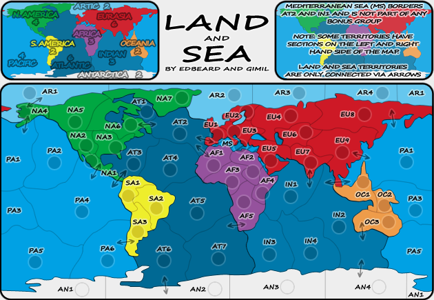
- Click image to enlarge.