Mapmaker(s): Minister X
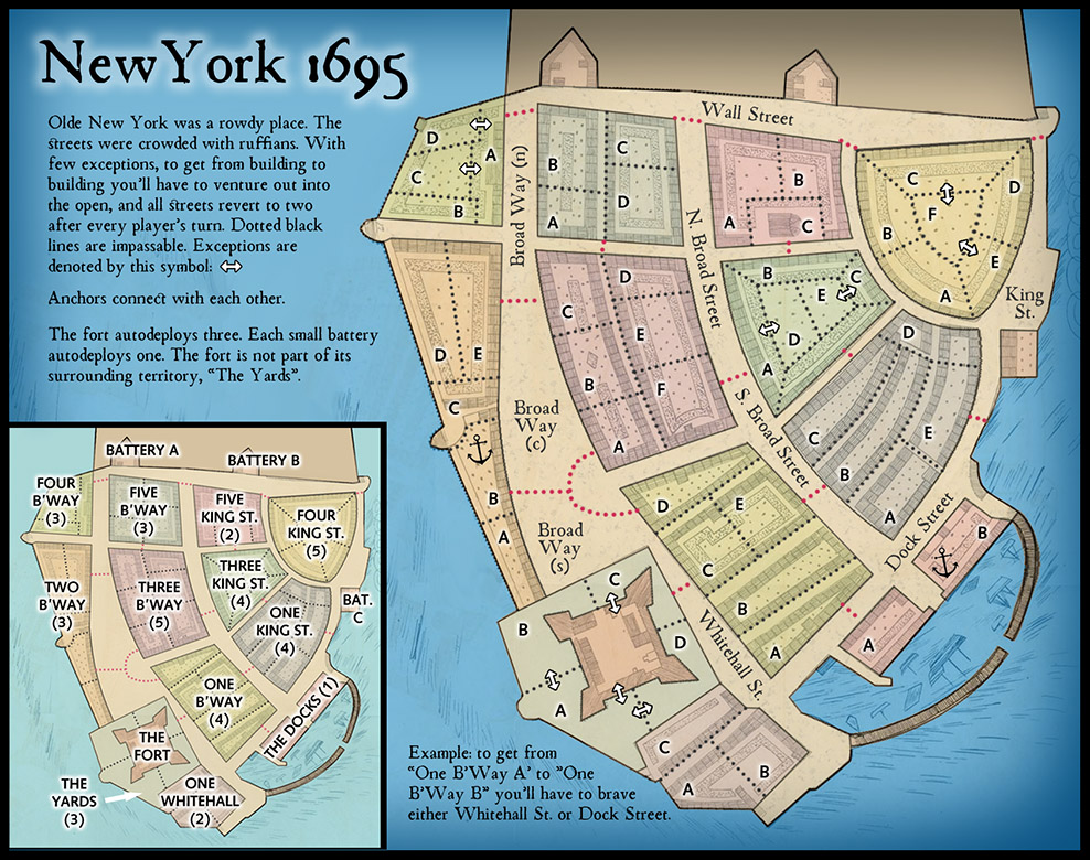
Number of Territories: 62
Special Features: Streets reset after every player's turn.
What Makes This Map Worthy of Being Made: It's probably just luck but in the last several games I've played I've gone first and been able to win a bonus that first turn, upsetting game balance right off the bat and winning each game quickly. This map is designed to prevent that from occurring. There will be lots of neutrals to start and you'll probably have to build up for a turn before venturing into the streets. In addition, this map is decidedly odd in that you can rarely go from one tert in a bonus region directly to another. You must usually go out into the street first. This makes bonus regions less cohesive and harder to hold. That will place a premium, at least early in the game, on just taking as many random terts as possible. The map is easy to read and use; the area and era depicted are interesting; and though not heavy on special features gameplay should be unique in character and unpredictable.

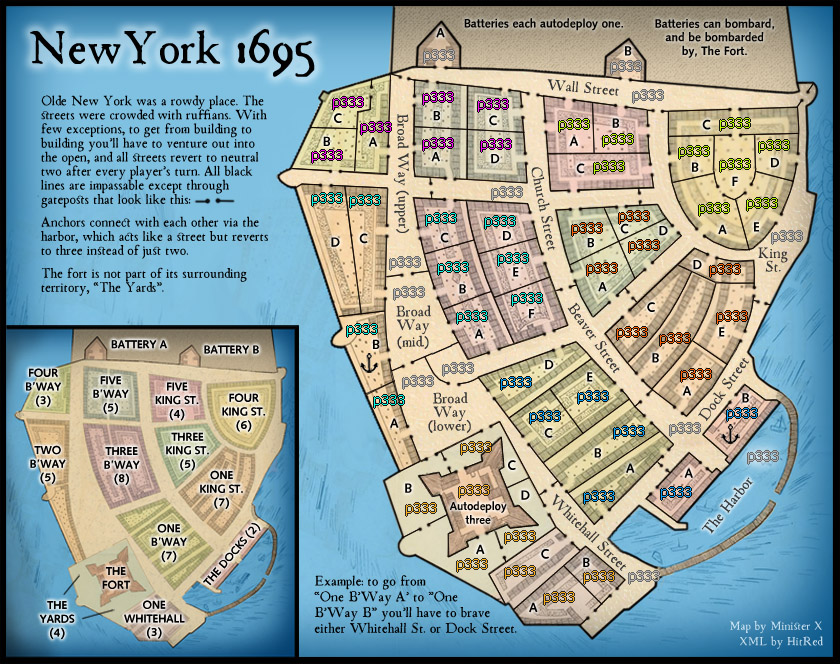
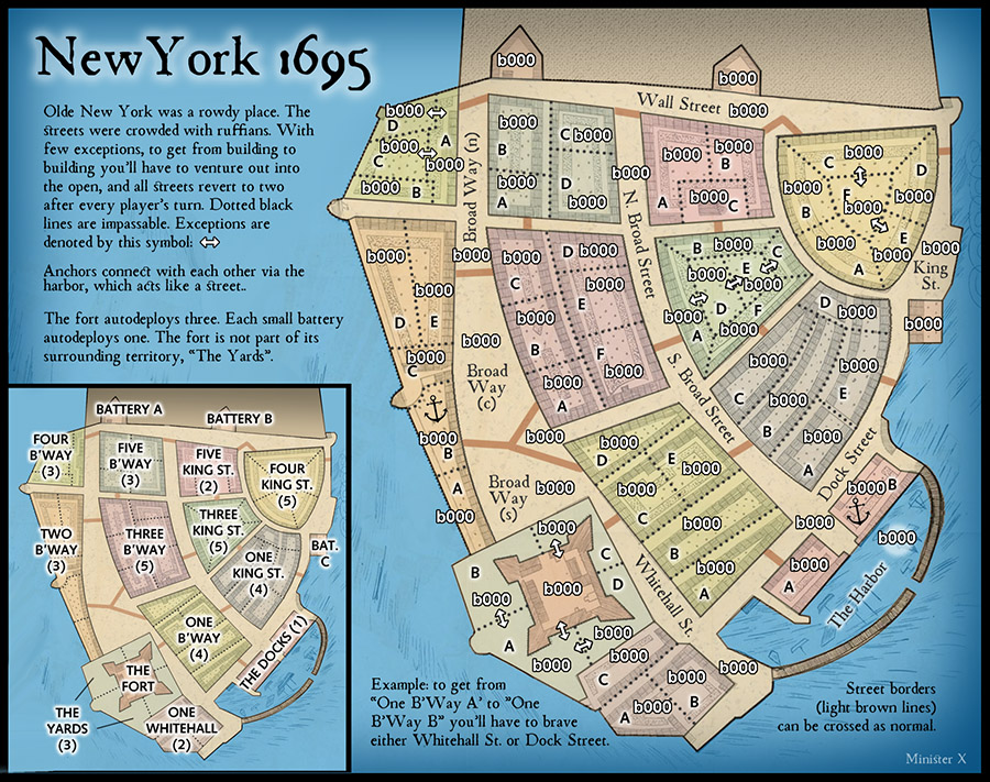
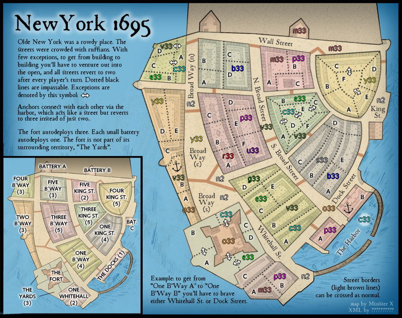
The Fort and The Yards surrounding it (at least A and C) should all start neutral. That area will be pretty important. The small batteries start neutral. Streets might start neutral 2, 3 or 4, and though I say they reset to 2, that is subject to play-testing. The Fort might start neutral more than just 3. I think that nearly half the bonus terts should start neutral for a two-player game, descending with player count but still more than is usual. That will accentuate the "slow start" character of this map. There would need to be some pretty careful playtest for this map to reach its potential. I'm quite unsure about the bonus amounts given the odd rules. What I've shown are just initial guesses.
Note: there are many versions of the underlying map, created by a John Miller back then. There are no known copyrights or limitations on use of the original, though some versions are offered for sale via image vendors. Many versions are on library and institutional websites and I found several that explicitly say "no limitations on use". I looked at several maps to get the street names. I realize that "Broad Way" and "Broad Street" can be a bit confusing but that's what they were called. I tried to find maps that would give me at least some hints about what I might call the various blocks of buildings that form the bonus areas but couldn't find a thing. I'm guessing that they were all mixed residential and commercial and though there might have been some subareas with specialized use none would take up the whole of one of my blocks. So I've chosen to use what amount to street addresses. If anyone can come up with a better suggestion please have at it.
FINALLY: I've posted several maps here recently and gotten fairly little in the way of feedback or comment. I like making maps so I won't complain about doing all this work for nothing but I am curious: are new maps still welcome at CC? If they are then there must be something lacking in my maps -- they must not be meeting the needs/wants of the CC cartographers (other than HitRed). I'd very much appreciate some guidance. What am I doing wrong or missing?
Latest Large Map:


