Conquer Club

Antarctica Map Second Try V1.

Have an idea for a map? Discuss ideas and concepts here.

Moderator: Cartographers

Forum rules
Please read the Community Guidelines before posting.

Antarctica Map Second Try V1.

Postby zach on Sat Aug 25, 2007 6:40 pm

I tried this a while ago and am trying again so here goes.

What think you guys?

Oh also this is Reverend Kyle posting this.

Image

For the record i'm using CS3.
User avatar
New Recruit zach
 
Posts: 29
Joined: Tue Mar 21, 2006 9:20 pm
Location: Being King of Bukkake.

Postby Bad Speler on Sat Aug 25, 2007 7:21 pm

Playability looks good, although there seems to be a 4-way corner at Queen Maud land/East Shwaben Ice shelf.

As for graphics, the ocean texture looks good to me, but the land texture could use adjusting, it seems too strong. Also, nice polar bear in the corner :D . the only problem is that polar bears dont live in the antarctic :(
Highest Score: 2532
Highest Position: 69 (a long time ago)
User avatar
Sergeant 1st Class Bad Speler
 
Posts: 1027
Joined: Fri Jun 02, 2006 8:16 pm
Location: Ottawa

Postby ParadiceCity9 on Sat Aug 25, 2007 7:51 pm

good luck with your army circles...
Corporal 1st Class ParadiceCity9
 
Posts: 4239
Joined: Thu Feb 15, 2007 4:10 pm

Postby edbeard on Sat Aug 25, 2007 7:58 pm

uhhh first of all I'm not sure he even needs them, and secondly even if he does use them he has plenty of space
User avatar
Lieutenant edbeard
 
Posts: 2501
Joined: Thu Mar 29, 2007 12:41 am

Postby Gilligan on Sat Aug 25, 2007 8:00 pm

The only one would be South Pole and Roosevelt Island.
Image
User avatar
Captain Gilligan
 
Posts: 12478
Joined: Thu May 11, 2006 4:59 pm
Location: Providence, RI

Postby d.gishman on Sat Aug 25, 2007 9:59 pm

Maybe change up the south pole, it looks like a giant lake in the middle right now
User avatar
Sergeant 1st Class d.gishman
 
Posts: 310
Joined: Wed Apr 04, 2007 11:11 pm

NOT BAD

Postby Keredrex on Sat Aug 25, 2007 10:40 pm

u could try making the color of the whole map the same....and either use light and dark to differentiate the territories... or use different textures ..... or make the borders colored lines with a uniform color/texture map.....it would make reading the map easier.... and feel more like the arctic.....
....I would also change the font but it might look better on a light blue ice looking map...almost the color you have now for the OCEAN....the OCEAN Should be more like that SOUTH POLE AREA.....

I think the moutains could use some work....
User avatar
Sergeant 1st Class Keredrex
 
Posts: 400
Joined: Sun Jan 14, 2007 1:41 am
Location: New York

Postby Balsiefen on Sun Aug 26, 2007 4:09 am

No polar bear

Nice map. i would change the land texture, change the colour of the pole to white, and darken the sea for more of a contrast
User avatar
Sergeant 1st Class Balsiefen
 
Posts: 2299
Joined: Wed Aug 30, 2006 6:15 am
Location: The Ford of the Aldar in the East of the Kingdom of Lindissi

Postby zach on Mon Aug 27, 2007 5:00 pm

Image


What I did:
I changed the colors to ones similar to on the arctic map. Those were decided to be quite cold colors at the time of that maps creation so I figure it worked. I don't want to do the uniform color thing, or other similar things because that is not the style of map I like. I dislike those maps very much.

Also I toned down the texture but kept it snowy, it's just not as hurt your eyes snowy.

I know there aren't polar bears in the antarctic, but I want to keep it. Really what animals are that cute that live in the antarctic?

South pole is a greyish white so much as not to mess with the borders. I don't intend to darken the water because I like the icy blue I have.

Fixed the 4 way borders.

Also, I am aware the borders need some cleaning up around them.

---reverend kyle.
User avatar
New Recruit zach
 
Posts: 29
Joined: Tue Mar 21, 2006 9:20 pm
Location: Being King of Bukkake.

Postby Gnome on Mon Aug 27, 2007 5:42 pm

I doesnt look that bad...
I would suggest making your outer borders a bit professional...
It's just like a little kid that can't draw between the lines :wink:
maybe making a shadow around the hole land will looks better...

Also, where are you going to put your army circles...
like 'South Pole' takes the hole country...it's better to put the army circle in the middle and than add south pole...

And I'm sure there are a lot of nice animals that live on Antartica you can use....

And your mountains looks...weird...I'm sure you can do better...

That's just my oppinion...
User avatar
Sergeant 1st Class Gnome
 
Posts: 388
Joined: Wed Jul 18, 2007 4:15 am
Location: Belgium

Postby zach on Tue Aug 28, 2007 1:08 am

Image

fixed some of the edging added glow.

are there any as cute as a polar bear?

--reverend kyle
User avatar
New Recruit zach
 
Posts: 29
Joined: Tue Mar 21, 2006 9:20 pm
Location: Being King of Bukkake.

Postby edbeard on Tue Aug 28, 2007 3:02 am

I think you said you were going to fix the borders. But, I'll just restate it again just to be sure and thorough. Outside edges have colour overlapping, and even on the interior you have overlapping.

As for the polar bear, I'd just use a seal. They actually do live in the antarctic. Or, an arctic tern. my source

I'd think you should use a different colour for that lower left continent. Something not blue preferably.

Definitely give those mountains another shot.

I don't like 1 border continents, but to each his own. I noticed that many of the continents can be held easier when expanding. By that I mean that you can theoretically get larger bonuses and still hold the same number of border territories or even less. I'm not if this is good or bad. Intended or not. Just wanted to point it out. 2 quick examples. The right continent and the red to its left. Also with the green continent expanding to that lower left. Maybe the bonus structure will make it irrelevant, or maybe it's not a problem to begin with.
User avatar
Lieutenant edbeard
 
Posts: 2501
Joined: Thu Mar 29, 2007 12:41 am

Postby Gnome on Tue Aug 28, 2007 3:48 am

Maybe you can also get rid of your polar bear by just adding your legend in that corner...
User avatar
Sergeant 1st Class Gnome
 
Posts: 388
Joined: Wed Jul 18, 2007 4:15 am
Location: Belgium

Postby reverend_kyle on Tue Aug 28, 2007 5:15 pm

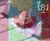
edbeard wrote:I think you said you were going to fix the borders. But, I'll just restate it again just to be sure and thorough. Outside edges have colour overlapping, and even on the interior you have overlapping.

As for the polar bear, I'd just use a seal. They actually do live in the antarctic. Or, an arctic tern. my source

I'd think you should use a different colour for that lower left continent. Something not blue preferably.

Definitely give those mountains another shot.

I don't like 1 border continents, but to each his own. I noticed that many of the continents can be held easier when expanding. By that I mean that you can theoretically get larger bonuses and still hold the same number of border territories or even less. I'm not if this is good or bad. Intended or not. Just wanted to point it out. 2 quick examples. The right continent and the red to its left. Also with the green continent expanding to that lower left. Maybe the bonus structure will make it irrelevant, or maybe it's not a problem to begin with.


The borders will be fixed a bit more in my next thing.. going through and fixing all the overlaps seems tedious to me, so I've made a goal to progressively fix it over each main update so eventually it will be all done.


Also I thought about a seal, but polar bears are just so darn cute.. and i'm also looking for a picture of one that screams golden. the polar bear isn't going to stay there don't worry.

As for the playability issues, I like the idea of having just one one border continent as that is how the classic map is too.

I don't see what you're talking about with the red either. Or even green. Moving from green to blue alone you add another border and with the big scale examples of how you could own alot with a big bonus and like 2 borders, well you'd think someone woulda broken you by then.

oh and i'm back from ban.
DANCING MUSTARD FOR POOP IN '08!
User avatar
Sergeant reverend_kyle
 
Posts: 9250
Joined: Tue Mar 21, 2006 4:08 pm
Location: 1000 post club

Postby Lone.prophet on Tue Aug 28, 2007 5:18 pm

i think you can better have white/creme color as territoria with colorred borders
Image
Captain Lone.prophet
 
Posts: 1467
Joined: Thu Oct 12, 2006 4:37 pm
Location: Your basement Muahaha

Postby reverend_kyle on Tue Aug 28, 2007 5:19 pm

zach wrote:I changed the colors to ones similar to on the arctic map. Those were decided to be quite cold colors at the time of that maps creation so I figure it worked. I don't want to do the uniform color thing, or other similar things because that is not the style of map I like. I dislike those maps very much.


---reverend kyle.
DANCING MUSTARD FOR POOP IN '08!
User avatar
Sergeant reverend_kyle
 
Posts: 9250
Joined: Tue Mar 21, 2006 4:08 pm
Location: 1000 post club

Postby edbeard on Tue Aug 28, 2007 5:27 pm

I'm just saying the a single continent alone has more borders than holding both continents together. In many places this cuts down on 1 or 2 borders. I'm not sure if that's good or bad for gameplay. Just pointing it out.
User avatar
Lieutenant edbeard
 
Posts: 2501
Joined: Thu Mar 29, 2007 12:41 am


Return to Melting Pot: Map Ideas

Who is online

Users browsing this forum: No registered users

cron