
This is version 4.
Version 3 can be seen here.
Version 2 can be seen here.
.Version 1 can be seen here.
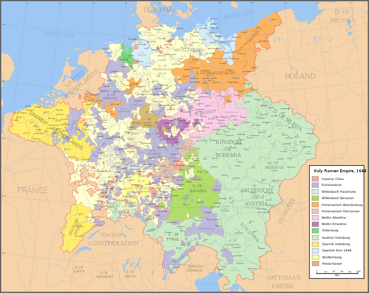
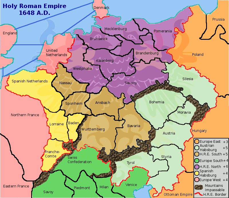
This map is based upon the boundaries set for the HRE following the Peace of Westphalia in 1648.
There are 36 territories forming 7 "continents"
Notes
1. This map was drawn using the GIMP
2. The principal resource used was this map
3. The impression of the Imperial Eagle was derived from the banner on this page


