DiM wrote:haven't read the thread so probably some of my points have already been discussed/suggested. sorry bout that.
so here goes:
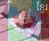
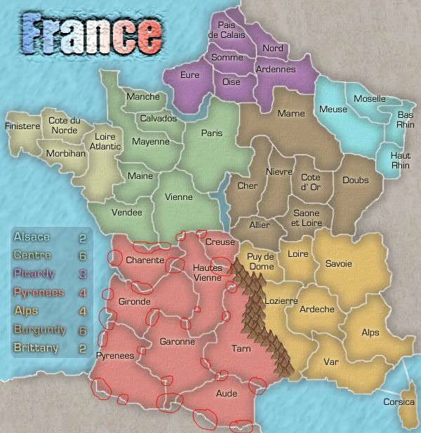
1. mountains. they don't fit with the style of the map at all. scrap them and try something else. the bevel on them and the white dots spoil everything.
2. corsica. the white outline is pixelated and strangely done. make it like the border of the lengend and round it a bit.
3. the gradient of the title should be horizontal not vertical. with blue on the left to represent the flag of france.
4. font. mother or alps.
5. legend. move it a bit down. at this moment it touches brittanny.
6. spelling. not sure but burgAndy should be burgUndy
7. borders. in some places the borders are thicker. like the easter most part of burgundy.
8. bevel. in the lower left corner the water looks like it is on top of the dead area.
9. strange lines. in the upper right corner you have some strange white lines on the margin of the map.
DiMs a bevel whore and when eh tells you to take it out you know its a problem