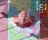
Hi this is the first map I have ever made so I would really appreciate your opinions. Anyways I was looking at all the current maps and realised no one had made one just of one city. With that in mind I decided to have a shot at making a London map. Here it is: It has 33 'countries' and each one is a borough of london. I though that this would give it an accurate geographical twist. I'm fairly sure that all the boundries are accurate but if any one can see any errors then please do let me know.
Last edited by fighter1405 on Tue Aug 22, 2006 5:05 am, edited 2 times in total.
Fireside Poet wrote:Knowing little about the landscape or London, I do recall in the 1800's a certain place called Whitechapel (?) -- where is that to be found?
Whitechapel is 1 mile east of the city of London and is famous because it was were Jack the Ripper operated. However it won't be on my map because it isn't a borough of London (Or at least I don't think it is)
Third and my only criticism where are the impassable points gonna be? at the moment the centre of town is brodered on everyside and very difficult for one player to take.
i agree, maybe this would be a map kind of like the Australia one in development, or Minnesota, where the continents are separated and there are bridges between them. that would minimize borders
Children, this is what happens to hockey players, druggies, and Hillary Clinton.
Ok I agree that there should be a bridge connecting central London and I will implement it ASAP. I also agree with the comment about central London having too many borders. Does anyone have any suggestions about what I could use to make some borders impassable or do you think I should just up the bonus for central London.
You could use the inner ring road as a boundary for central london.
"I do not feel obliged to believe that the same God who has endowed us with sense, reason, and intellect has intended us to forgo their use."
- Galileo Galilei
fighter1405 wrote:... I also agree with the comment about central London having too many borders. Does anyone have any suggestions about what I could use to make some borders impassable... Thanks for your comments
I told you already.
I wrote:i agree, maybe this would be a map kind of like the Australia one in development, or Minnesota, where the continents are separated and there are bridges between them. that would minimize borders
just a suggestion
Children, this is what happens to hockey players, druggies, and Hillary Clinton.
Thanks everyone for your feedback. I am now in a position to release my second version of the map. I have removed the Thames and seperated the different 'continents'. Here it is:
I think rev 2 looks horrible. It no longer looks like London IMO. I reckon using roads as barriers could be much better. Specifically, the inner ring road seperates central London from outer London; M1 West/North; M4 Hounslow/Richmond; M11 Redbridge/ Waltham Forest. The Thames seperates West from South. Bridges or underpasses could provide connections as required.
"I do not feel obliged to believe that the same God who has endowed us with sense, reason, and intellect has intended us to forgo their use."
- Galileo Galilei
"I do not feel obliged to believe that the same God who has endowed us with sense, reason, and intellect has intended us to forgo their use."
- Galileo Galilei
I would agree with you. I myself was dissapointed with how version 2 turned out so I decided to try your idea. Here is a rough version of what version 3 should look like:
Obviously this is only rough and I will tidy it up.
I still have to make city bigger
Add a link accross the Thames to join up the city centre
and improve the solid borders and arrows
Last edited by fighter1405 on Mon Aug 21, 2006 3:51 pm, edited 1 time in total.
East London is not a good name for a continent. It's also a major port in South Africa. Actually separating them would be good. the L is not capitalized in one part of the key. Love the map tho.
Children, this is what happens to hockey players, druggies, and Hillary Clinton.
As for gameplay, I see that North London has a bonus of 2, while it has 3 borders to defend, and Central london has a bonus of 5, while it only has 2 borders to defend.
This seems like just another old map to me. If I was to see a map of london i'd rather it was much more concentrated on central london, with maybe some landmarks or something to make it special.
It is a shame, as I was born in bexley and live in what must be the city, but I doubt I would play this map much even with such strong ties to it.
8 countries with 2 borders and 4 countries with 3 borders? The continents are still strange to say the least. I think you need more connections for the middle continent definitely and a few other ones as well. And yeah, don't start a new thread for every update or people won't be able to see the progression of the map and why certain decisions were made (or what questions may have already been answered.)


 Children, this is what happens to hockey players, druggies, and Hillary Clinton.


 MIDDLE AMERICA MAP